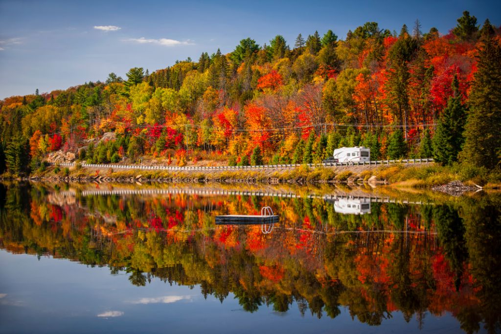
Experience the fascinating Canadian Rocky Mountains and the seemingly endless wilderness of British Columbia during this camper trip. There are numerous attractions which are situated against the backdrop of imposing mountains. Enjoy pure relaxation in the hot water of Harrison Hot Springs, before going by ferry to Vancouver Island and Victoria. Vancouver, the “Pearl of the Pacific,” will be the culmination of the trip.
/
Magazine
/ The wide west of Canada
The wide west of Canada
Your route
- From Calgary to Vancouver
- 14 - 21 days / 1,550 to 1,700 km
- Best time to travel: May to September
Arrival in Calgary and collection of the camper
Calgary is located in Western Canada, in the southern part of the Province of Alberta, near the Rocky Mountains. With nearly 1.3 million inhabitants, it is the largest city in this province and it is also Canada’s fifth largest city. Calgary is slightly hilly and is situated at the confluence of the Bow River and the Elbow River at Fort Calgary.
In a constant competition against the provincial capital of Edmonton, Calgary has been known among the tourists due to the Winter Olympics that took place here in 1988. The memory of the games is still present in many places around the city, especially at the Olympic Plaza.
Like many cities in the wide country of Canada, Calgary developed virtually “out of nothing” in a very short time, at least for European standards. The first Europeans came here before the end of the 18th century and the area around Calgary was the settlement area for the Blackfoot.
A cornerstone of this urban “civilisation” was the establishment of the Royal Canadian Mounted Police in 1875. The place was established as Fort Calgary in 1876. Today, you can learn much about the beginning of the famous “Mounties,” the mounted police officers in red uniform (opening times: year-round except some public holidays, 9 am to 5 pm, admission for adults: $12)
The population was growing together with the construction of the Canadian Pacific Railway. The city became the centre of cattle breeding. The annual Calgary Stampede reminds the visitors about this tradition (see Highlights & Tips). The discovery of huge oil reserves at the end of the 1940s turned Calgary into an economic metropolis.
There are many attractions that can be admired in Calgary. For example, you can pay a visit to Heritage Park in the southern part of the city, where you will find original houses from the past and have a glimpse into the settlers’ lifestyle. What is more, there is a horse-drawn carriage ride available.
For a beautiful view of the city, it is recommended to visit Salisbury Avenue. There is more to see in the countryside. From the 191-metre high Calgary Tower, you will be able to admire the distinctive Rocky Mountains in the west. The ski jump tower and the Olympic landmarks are also visible from above.
Highlights & Tips
We recommend you to take the route from Calgary, as there are cheaper taxes when it comes to car rentals in the Province of Alberta in comparison to Vancouver, located in the neighbouring Province of British Columbia.
Another tip is that if you plan your trip in the first half of July, you can see the Calgary Stampede. It is a ten-day spectacle which takes place on an annual basis and is similar to the Oktoberfest in Munich. During this time you can learn more about old Canadian traditions. The tradition has its roots in a Rodeo competition that took place here in 1912. Stampede Park is located south-east of Downtown. The rodeo is a colourful combination of an agricultural festival, a fair, an Indian village, and a place with various food stands. A necessary accessory and a practical souvenir, which will be useful during the Calgary Stampede, is a cowboy hat. The event will take place on the following dates: 5-14 July 2019, 3-12 July 2020.
Apart from all the attractions, shopping venues, and restaurants in the city, you can also relax on a tram called the C-train.
Skywalks are a unique feature of Calgary. These are special glass transitions between skyscrapers. What is more, you need to remember that Skywalks and many shops are closed on Sundays.
Calgary – Banff
Suggested route: Calgary – (Kananaskis-Tal) – Canmore – Banff
Stage distance: approx. 125 km (plus an optional detour through the Kananaskis Valley to Canmore, approx. 80 km)
From Calgary, you will travel on the Trans-Canada Highway or the parallel Bow Valley Trail (#1A), where the flat plains of the Province of Alberta pass the Rocky Mountain Foothills.
The next optional destination is the Kananaskis Valley. In the near vicinity, there is a place where slaloms and downhill races were held during the Winter Olympics in Calgary. Kananaskis is not only well-known due to winter sports. It also offers many possibilities for hiking and outdoor activities in the summertime. You will experience a panorama of wide green meadows and forests, diverse wildlife, deep blue lakes, and the rapids of the Kananaskis River. This unique backdrop is an inseparable element of each Canadian holiday. The natural environment invites you to make a stopover in the green Bow Valley Provincial Park.
On the Kananaskis Trail (#40), you will have an opportunity to take a detour to see the venues used during the Winter Olympics. They are perched against the backdrop of extraordinary nature. The Smith Dorrien Trail passes through the Lower Kananaskis Lake and the Spray Valley Provincial Park, and then, back to the Bow River Valley and to Canmore.
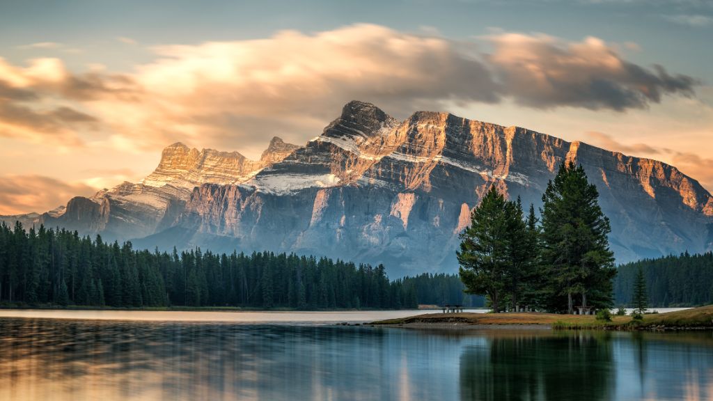
Along the Bow River, you will travel from Canmore to Banff, a perfect base to explore the magnificent Banff National Park. The small town of Banff is the centre of the homonymous national park and offers good shopping venues, especially when it comes to souvenirs connected with Canadian wilderness.
The Banff National Park was established in 1885 and is the oldest national park in Canada. It has 6,641 square kilometres. The remote Banff Upper Hot Springs and Sulphur Mountain, already pointing to the hot sulphur springs, were discovered during the construction of the railway in 1883. The national park with its diverse natural beauty invites outdoor enthusiasts to participate in various activities, for example a photo safari which enables the visitors to admire the fauna and flora of the impressively beautiful mountains.
Highlights & Tips
Those who would like to experience the Banff National Park from above can take a ride on the Banff Gondola, a cable car which climbs Sulphur Mountain. The large car park in the valley is accessible for campers and is located minutes from Banff. The 1.6-kilometre cable car starts at the car park and will take you 2,281 metres above the sea level. Mountaineers can tackle the nearby 700-metre difference in altitude by following a 5.5-kilometre hiking trail.
Under the name Banff Explorer, there are two attractions included in one price: a mountain ride on the Banff Gondola and “Banff Lake Cruise,” which is a boat ride on Lake Minnewanka (adults from $98, children from $49).
Banff – Jasper
Suggested route: Banff – Lake Louise – Bow Lake – Peyto Lake – Jasper
Stage distance: approx. 290 km
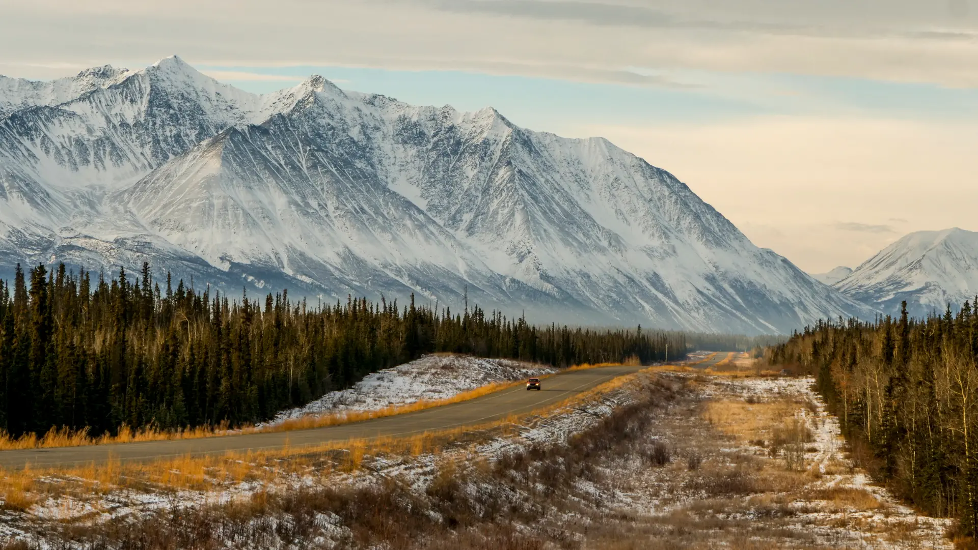
After passing Lake Louise, you will continue on the Trans-Canada Highway in the western direction. Turn north-west on the famous Icefields Parkway (#93), which continues through the impressive mountain landscape of the Canadian Rockies. In fact, the Icefield Parkway is considered to be one of the most beautiful panoramic roads in the world. Past Bow Lake and Peyto Lake, which can become optional stopovers, you will reach Jasper.
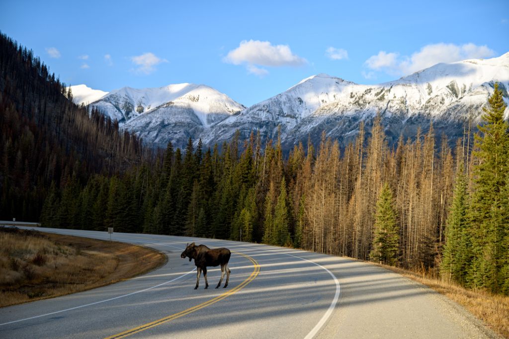
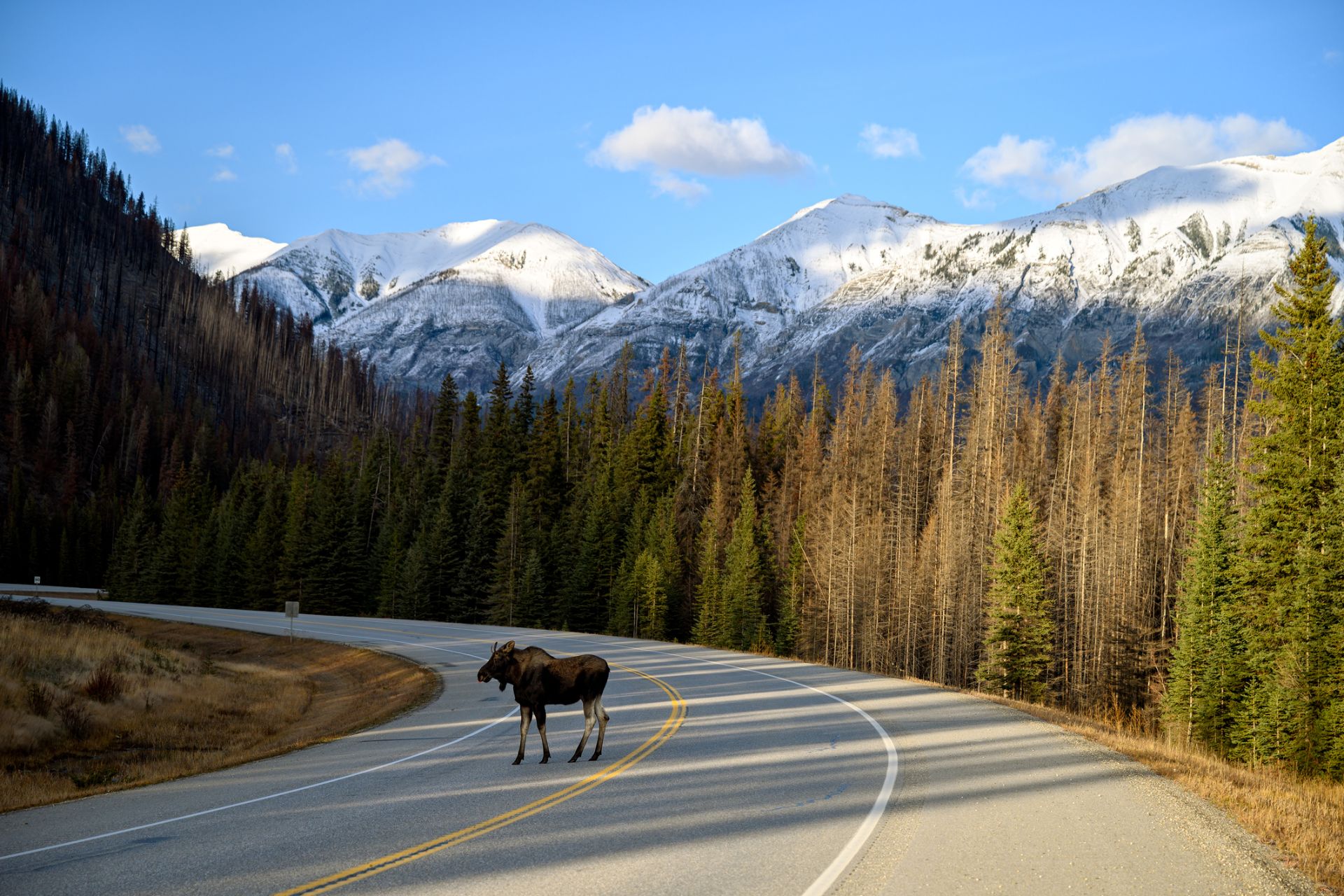
The tranquil town of Jasper is the starting point for many activities in the national park. Numerous mountain lakes and peaks in Canada’s largest mountain national park attract outdoor and mountain sports enthusiasts. The Jasper National Park offers countless possibilities which are worthwhile a longer stay.
Medicine Lake and Maligne Lake, located in the Maligne Valley, as well as the grand Maligne Canyon are among the natural beauties of the area. There are opportunities to participate in white-water rafting and to admire the majestic Athabasca Waterfalls and the Sunwapata Falls. Mt. Edith Cavell, a mountain literally untouched by human, offers a dream setting. There is also a possibility to marvel at the eternal ice of the Cavell Glacier, the Angel Glacier, and the Athabasca Glacier as well as the Columbia Icefield Glacier.
Highlights & Tips
Those who would like to experience the Jasper National Park from above can take a ride on the Jasper Sky Train, a gondola (adults: $44.95, children: $22.95) which will take you to an altitude of 2,277 m.
The Glacier Skywalk in the Jasper National Park is the newest attraction in the Canadian Rockies. By following a 500-metre long road, visitors can enjoy a panoramic view of the 280-metre deep Sunwapta Valley, which is located against the beautiful backdrop of mountains. There is also an observation deck with glass floor located 30 metres above the abyss. This attraction might cause some difficulties for those who suffer from vertigo. The tour begins at the Columbia Icefield Glacier Discovery Centre, approximately one hour from Jasper. From there, you can take a special shuttle service to the nearby Glacier Skywalk.
From the Columbia Icefield Glacier Discovery Centre, you can take a tour on a special vehicle – the Canadian rustic style of nature exploration – going right through the impressive Athabasca Glacier.
The two adjacent national parks of Banff and Jasper offer a great combo package – Glacier Skywalk, Glacier Adventure, Banff Gondola, and Banff Lake Cruise (Ultimate Explorer: adults from $173, children from $87).
Jasper – Valemount
Suggested route: Jasper – Tête Jaune Cache – Valemount
Stage distance: approx. 125 km
From Jasper, you will drive on the Yellowhead Highway (#16) and pass Lake Yellowhead and Lake Moose to the Mount Robson Provincial Park. Mount Robson is the highest mountain in the Canadian Rockies with 3,954 metres of height. In Tête Jaune Cache, you will turn on Yellowhead Highway (#5) and drive south.
There are a lot of attractions near the Mount Robson Provincial Park. There is a variety of wild animals that can be found in this part of the Rockies, including black bear, grizzly bear, moose, and caribou. Near Tête Jaune Cache, just north of Highway #16, you will find idyllically located Little Lost Lake, which will invite you to jump in its cool water. There is a hiking trail leading to the lake.
The hidden Lake Kinbasket, located south-west of Valemount, attracts anglers. Directly along the route, on Highway #5 at Tête Jaune Cache, you will find the Jackman Flats Provincial Park with a unique eco-system which can be explored by following different trails.
One kilometre south of Valemount on Highway #5, there is a small reserve, namely the Robert W. Star Council Wildlife Sanctuary. There are many bridges, observation towers, and platforms along the way which will be ideal for the observation of nature.
Highlights & Tips
The spring waters of the Fraser River are home to king salmon, which returns here to spawn in late summer. You can also admire here the Rearguard Falls, which are located south of Highway #16, just before Tête Jaune Cache. The spawning migration of king salmon can also be observed in the George Hicks Park, near Valemount. The animals have to travel nearly 1,300 km from the Pacific Ocean to Valemount.
Valemount – Clearwater
Suggested route: Valemount – Clearwater
On the Southern Yellowhead Highway, your trip will continue along the Blue River in the direction of Clearwater, where the Dutch Lake can be found. Clearwater is located at the entrance of the Wells Gray Provincial Park, which is a paradise for nature lovers and a great place for leisure activities such as hiking, canoeing, kayaking, fishing. The Helmcken Falls, the Dawson Falls, and traces of extinct volcanoes are among the many natural highlights that you can admire there.
The Wells Gray Provincial Park is located on a volcanic field and is part of a large nature reserve in the western part of the Cariboo Mountains. In addition to numerous smaller lakes, you can admire Hobson Lake, Azure Lake, Clearwater Lake, Mahood Lake, and Murtle Lake. The last one is known as the largest lake in North America; however, it cannot be used by motorboats. The highest summit in the park reaches the heights between 2,600 and 2,900 metres. In the southern part of the park, there is the Clearwater River Valley, which is less than 500 metres deep.
Highlights & Tips
The Helmcken Falls, where the basalt rocks create 144-metre high natural support for the Murtle River, can be accessed from the Clearwater Valley Road. In addition to a vantage point, which can be reached in only two minutes on foot, there is the 10-kilometre spectacular Helmcken Falls Rim Trail. It runs very close to the waterfall, but should be treated with caution – especially when you travel with children – because it is unsecured.
Clearwater – Kamloops
Suggested route: Clearwater – Barriére – Kamloops
Stage distance: approx. 125 km
From the Southern Yellowhead Highway, travel further south towards Kamloops. As a stopover, you can visit Barriére. The city was initially established as a fur trading post. The name comes from the rocks and nets in the water which were used by the First Nations as a barrier to prevent the passing of boats.
Finally, at the end of this stage, you will see some civilisation. Kamloops, located in the Province of British Columbia, was founded as one of the trading posts of the Hudson’s Bay Company in 1812. The city lies at the confluence of the North Thompson River and the South Thompson River. In the language of the indigenous people, the Secwepemc, Kamloops means “where the rivers meet.” Today, you will travel by road and by rail to see what makes Kamloops a bustling transport hub of the province. There are many lakes in the area, such as Kamloops Lake, Paul Lake, Roche Lake, Adams Lake, Shuswap Lake, and Lac Le Jeune.
Highlights & Tips
Search for clues from the past in the Secwepemc Museum & Heritage Park or Kamloops Museum & Archives.
Kamloops – Harrison Hot Springs
Suggested route: Kamloops – Merritt – Hope – Harrison Hot Springs
Stage distance: approx. 255 km
Today’s route runs on the Princeton-Kamloops Highway (#5A). It will often lead you close to the water, past Shumway Lake, Trapp Napier Lake, Stump Lake, and the largest of them Nicola Lake, towards Merritt, located in the Nicola Valley. The place was founded in 1893 under the name Forksdale, and then, it was renamed in the honour of William Hamilton Merritt III.
In Merritt, you will switch on the Coquihalla Highway (#5) or the parallel Coldwater Road, running along the Coldwater River, and continue through Hope to Harrison Hot Springs.
The stage goal is Harrison Hot Springs, which is a small resort town on the southern shore of Harrison Lake. The place offers a sandy beach and two mineral water springs, to which the village owes its name. The two springs have their own names, Potash and Sulphur, with a water temperature of 40°C and 65°C respectively. These two springs are among water bodies with the greatest amount of mineral substances in the world. The hot springs were already worshipped by the Indian tribe of Chehalis. The immigrants who settled the area took up gold prospecting.
Highlights & Tips
Harrison Hot Springs offers hot springs to relax, a stay on the beach, or a short stay in the spa. You can relax while building sand castles. In September, there is even a competition in building sand castles organised in the area. It is held in Harrison on an annual basis.
In the middle of summer, there is an art festival organised here on an annual basis. It is called the Harrison Festival of the Arts.
Harrison Hot Springs – Victoria
Suggested route: Harrison Hot Springs – Vancouver – Horseshoe Bay – Nanaimo – Chemainus – Victoria
Stage distance: approx. 200 miles (320 km) incl. ferry crossing (plus optional tour from Duncanto Lake Cowichan, approx. 37 miles (60 km))
From Harrison Hot Springs, you will travel through Agassiz on the Trans-Canada Highway (#1) towards Vancouver. Through North Vancouver and West Vancouver, you will get on Highway #1 to Horseshoe Bay. From there, you will take the ferry to Nanaimo on Vancouver Island. Along a rugged coastline, you will take the Island Highway through Chemainus towards Victoria.
If you have not got enough of the attractions of Western Canada, you can take a short detour before going to Duncan and take the Cowichan Valley Highway to Lake Cowichan. Lake Cowichan First Nation is the smallest community belonging to the Hul'qumi'num Group on Vancouver Island. Cowichan comes from the Hul'qumi'num word Khowutzun, meaning hot land or land warmed by the sun, as there is no ice on the lake and river.
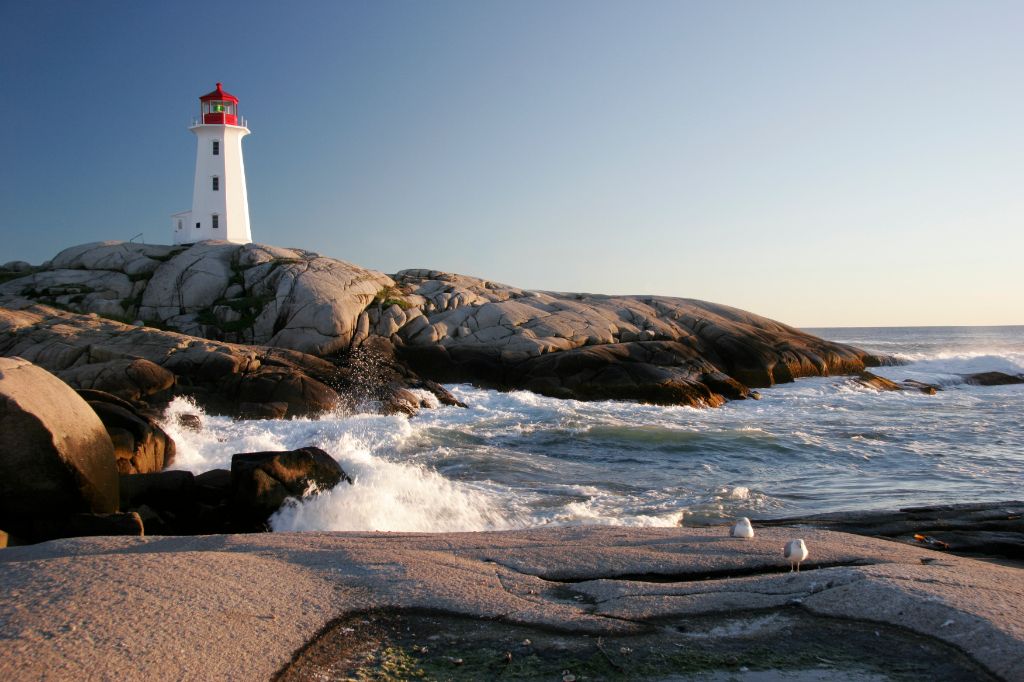
From Duncan drive further to the south of Vancouver Island, the largest island of North American West Coast, to Victoria. Victoria is surrounded by the mainland of British Columbia, Canada in the east, and by the U.S. state of Washington in the south. You will be able to admire views of the sea, mountains, dense forests, lush green parks, and beautiful coastlines which will be a dream backdrop.
In Victoria, the West Coast terminus merges with Anglo-European and Asian traditions. There is something for everyone. You can have a picnic on the beach, an English afternoon tea, a bike ride, or a ride on a horse-drawn carriage. There are art galleries and historic buildings which create an excellent ambience. What is more, worth seeing are also the Inner Harbour, Bastion Square, and Beach Hill Park, which is located just outside Butchart Gardens and is one of the most beautiful gardens in Canada.
Highlights & Tips
If you have never seen whales in the open sea, the best opportunity for whale watching is in Victoria. One of the providers, Prince of Whales (www.princeofwhales.com), offers a 3-hour tour and the prices range from $80 to $115.
Victoria-Vancouver
Stage distance: approx. 68 miles (110 km) incl. ferry crossing
With B.C. ferries you will travel around many gulf islands, back to the mainland. There, you can explore various shops, parks, restaurants, theatres, and other attractions in downtown Vancouver.
Thanks to its unique location, in the near vicinity of the water, beaches, a harbour, and coastal mountains are all present in one place. Due to that fact, Vancouver is known for being “the Pearl of the Pacific.” The city was founded during the gold rush in the 1960s and developed after the opening of the transcontinental railway in 1887. Within a few decades it became a metropolis. Today, Vancouver is the largest port of Canada.
Enjoy the special atmosphere of the city on the Pacific coast, visit such places as Chinatown, and drive to Robson Street, Vancouver’s famous shopping district located in the heart of Downtown.
Highlights & Tips
Learn why Vancouver is one of the most beautiful and greenest cities in the world. The best way to do it is to take a guided bike tour (http://biketourvancouver.com/). Visit Stanlay Park with its totem poles, go to English Bay, False Creek, and - via Granville Island - back to Downtown.