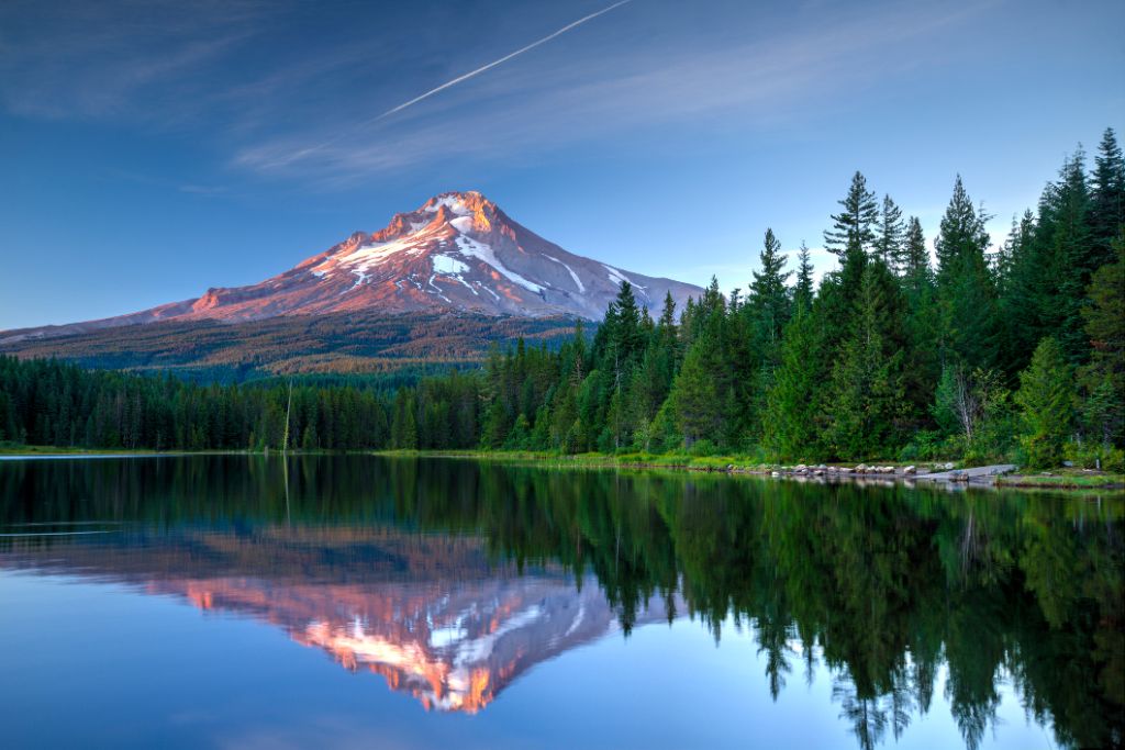
During this motorhome trip, you will first travel along the Pacific coast of Southern California to San Diego and then, moving inland up to Phoenix, Arizona. From Phoenix, the route will lead you through stunning national parks and natural highlights in the west of the United States.
/
Magazine
/ From Los Angeles to San Francisco
From Los Angeles to San Francisco
Your Route
- from Los Angeles / to San Francisco
- 21 days / 3,700 km
- Best time to travel: May/June or September/October
Arrival in Los Angeles and collection of the camper
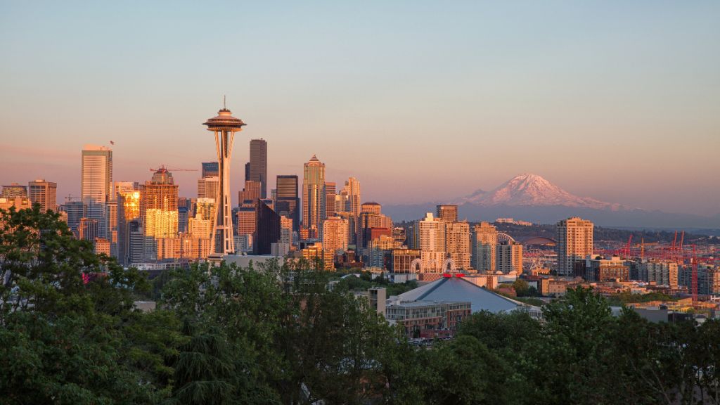
Los Angeles is the largest city in the United States, after New York City, and has a population of about 3.5 million. Los Angeles metropolitan area has a population of more than 14.5 million. In clear weather in the winter time, you can see the snow-capped peaks of the San Gabriel Mountains.
The tour will take you through the city’s Downtown. El Pueblo De Los Angeles Historic Park is the area where the city has its beginning. In 1781, the Governor Felipe de Neve, together with 11 families, founded “El Pueblo de Nuestra Señora la Reina de los Ángeles.” Later, the place’s name of Los Angeles was abbreviated. On the Old Plaza located on North Main Street, the former village centre, there stands the oldest church in Los Angeles. It was completed in 1822 and named the Old Plaza Church. Olvera Street, at the northern end of the plaza, between North Main Street and Alameda Street, is one of the oldest streets in Los Angeles. Here, you can find Little Mexico, where you can sometimes watch Mexican dances, listen to Mariachi music, and visit some of the authentic restaurants and stalls with Mexican food. Little Tokyo is on 1st Street, between Main Street and Alameda Street, close to the City Hall. Chinatown is near North Broadway and North Hill Street – it is, however, much smaller than the one in San Francisco.
Later, you will move away from the centre towards Hollywood. In 1910, it was incorporated into Los Angeles as a suburb. It is here that the first film studio was founded in 1911. The film industry had significant contribution to the growth of the city. In the meantime, major studios that had been established in the San Francisco Valley started to move to Burbank or even further away. Still, there were many film and even television studios in Hollywood. You can suddenly find yourself in a street where a film scene is being filmed at a given moment. Hollywood is still a magnet for movie lovers all over the world. The Mann’s Chinese Theatre, on 6925 Hollywood Boulevard, where you will find hand and shoe imprints of the biggest stars in the film world, is also worth paying a visit. It will be great fun to search for the star belonging to your favourite actor on the “Walk of Fame.”
Continue to Beverly Hills. You can visit one of the exclusive shops located on Rodeo Drive or simply stroll around the area. East of Beverly Hills, in West Hollywood, you can find numerous restaurants where many movie and TV stars can be spotted. The restaurants are located on La Cienega Boulevard and Melrose Avenue. On the latter, you will also find fashion boutiques and antique shops. In Griffith Park, a recreation area within the city, there is an amphitheatre, the Greek Theatre – on 2700 North Vermont Avenue – where there are open-air concerts and ballet shows taking place in the summer. The Griffith Observatory & Planetarium can be found on the southern slope of Mount Hollywood and is a popular vantage point for locals and visitors alike. It offers a beautiful view of Los Angeles.
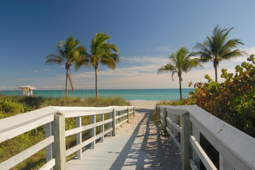
Marina del Rey is also worth a visit. It is located in the near vicinity of Los Angeles International Airport. What is more, you can also take a stroll along the “Boardwalk” from Venice Beach. There, you can admire weight lifters, roller runners, break dancers, clowns, jugglers, piano players, and other street performers. Santa Monica, situated between Venice and Malibu on the Pacific Ocean, is a small town with a pier, shops, and restaurants.
Highlights & Tips
Plan your sightseeing tour
The city is a huge urban area. Therefore, public transportation is often an insufficient means for moving from one place to another. It is best to have your own car to move around. The “rush hour” lasts here almost all day. The main artery is usually very congested. You should be prepared that you will be moving only a small distance at a time. Before you take your camper to Los Angeles, it is advisable to plan the whole stay in advance and carefully schedule each attraction.
Los Angeles – San Diego
Suggested route: Los Angeles – San Juan Capistrano – San Diego
Stage distance: approx. 137 miles / 220 km
By following this route, you will arrive in San Juan Capistrano, which lies between the Santa Ana Mountains and the sea. If you want to visit Mission San Juan Capistrano, you have to exit the highway and drive on the Ortega Highway. The mission, which was founded on 1 November 1776 by father Junípero Serra, consists of three churches. Only two out of three can be still seen today. There are also the ruins of the third one in the area. Serra Chapel was constructed in 1777 and is the oldest building in California.
The route continues to Oceanside, where another mission is located, namely Mission San Luis Rey de Francia named after Louis IX, the King of France. Camp Pendleton, one of the largest amphibious training centres is also located in the area. Then, you will travel through Carlsbad, named after a town in the Czech Republic and also a spa resort.
Afterwards, you will reach San Diego. The downtown of San Diego, Gaslamp Quarter, invites tourists for a stroll and gives a good overview of the city’s architectural and economic history. San Diego has the largest natural harbour in America. It also has a large naval base and a training centre for seamen. There are numerous large warships anchored in the bay. It is also a university town and a recreation area with many sports facilities.
You can also visit California’s oldest existing settlement, dating back to the period before 1800, namely the Old Town San Diego Historic Park. The spectacular San Diego Coronado Bay Bridge connecting the mainland to North Island, where the elegant Hotel Del Coronado (the filming location of “Some Like It Hot” starring Marilyn Monroe) can be found, is also worth a visit. Balboa Park, located in the middle of the city, is a recreation and cultural centre. The Tower of California, which is 60 metres high, with a carillon, consisting of 100 bells that chime every quarter of an hour, is a great highlight of the city.
San Diego Zoo, which is located in Balboa Park, is one of the largest zoos in the world and is a home to the popular Australian koalas. Sea World is another attraction in San Diego. It can be found in Mission Bay Park. It is an oceanarium with various shows performed by animals, including killer whales, dolphins, penguins, sea lions, and walruses.
Highlights & Tips
Panoramic view of San Diego Bay
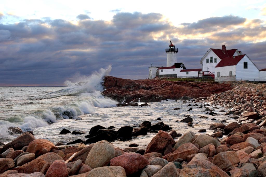
You can admire a nice overview of the bay and the city from Point Loma and the Cabrillo National Monument, located on Cabrillo Memorial Drive (SR 209). You will reach the place by driving past a military cemetery. The historic lighthouse, which guided the ships with light signals between 1855 and 1891, has been meticulously restored.
Museum tour in Balboa Park
There are seven museums in Balboa Park, among other things, there are: the Aerospace Historical Center and the San Diego Automotive Museum. You can buy a pass, which entitles you to visit four of the seven museums. This pass can be purchased either in one of the museums or in Balboa Park Information Center in the House of Hospitality.
San Diego – Palm Springs
Suggested route: San Diego – Beaumont – Palm Springs
Stage distance: approx. 140 miles / 224 km
Today, you will travel towards Beaumont/Indio and then, towards Palm Springs. The well-known resort of Palm Springs is a popular tourist destination. There are many top class hotels, holiday homes, and expensive apartments in the north of the Colorado Desert. The mineral springs have been a magnet for many holidaymakers since the turn of the century. Many Hollywood films have been shot here. There are numerous tennis courts, swimming pools, and exclusive shops which make up the “playground” of the rich.
The Agua Caliente Indian Reservation lies about 7 miles (11 km) south of Palm Springs and is covered with about 3,000 palm trees. Three different canyons can be accessed by hikers: in the Palm Canyon, which is about 15 miles (24 km) long, you can see Washingtonia palms, which are between 1,500 and 2,000 years old. The other two canyons are the Andreas Canyon, with many different rock formations, and the Murray Canyon, which is the most accessible one. It offers spectacular rock formations, caves, and mortar holes. The reservation is open daily from 8 am to 5 pm, between September and June. During the summer, it is closed for visitors.
Highlights & Tips
Palm trees in the snow
North of Palm Springs, you can visit the Aerial Tramway, which are gondolas running up the often snow-capped San Jacinto Peak. The valley station is located on the Tramway Road, about 3 miles (5 km) south-west of SR 111, at an altitude of 800 metres. The mountain station is located at an altitude of 2,600 metres. In 15 minutes, you will cover the distance of 2.5 miles (4 km).
Palm Springs – Phoenix
Suggested route: Palm Springs – Blythe – Phoenix
Stage distance: approx. 345 miles / 560 km
On your trip to Phoenix, we recommend a detour to the Joshua Tree National Park, which got its name from Joshua trees. These “trees” are actually Liliaceae and thrive only in the Mojave Desert as well as in the hot and dry highlands of Mexico. After the visit, you will continue your journey to the south of the park and then, in the direction of Blythe and up to Phoenix. You will pass sand dunes on the border with Arizona. The further east you drive, the sparser the land becomes.
In the Queen Valley, you will see diverse rock formations. One of the features of the park is the transition of the low Colorado Desert into the high Mojave Desert. In Cholla Cactus Garden, you will find a rich collection of Bigelow cacti. On the short and flat path which is signposted, you will find information about the plant and animal life in the Colorado Desert.
Phoenix is located at an altitude of 330 m in the Valley of the Sun. It has 1.5 million inhabitants. The sun shines here 300 days a year on average. In the summer, the temperatures often exceed 40°C. Phoenix is a western town, where the ancient cultures of the Spaniards, Mexicans, and Indians blend with the modern progress. Today, it is a major industrial city as well as the business and cultural centre of South-West. It is also an excellent starting point for the exploration of the American West. The city is surrounded by three mountain ranges and is located on the banks of the Salt River, where the Hohokam Indians created an artificial irrigation system in 1,400 BC.
Among other things, the State Capitol Buildings with a beautiful copper roof, located on Washington Street, as well as the Congress and Cultural Centre are impressive. The Arizona State Capitol Museum was built in 1900 and served as territorial congress building until 1912. You can see the documents and artefacts which date back to the early stage of Arizona’s development at an exhibition.
The Heard Museum is a museum of anthropology and primitive art, one of the best of its kind in the whole United States. The Hohokam Indians lived in prehistoric times in that area. In this museum, among other elements, you will see various representations of their culture. What is more, there are numerous instances of Native American Indian art, specifically exhibitions presenting items from the south-western part of the United States.
Highlights & Tips
Joshua Tree National Park
There are three visitor centres in the park. The main visitor centre, Oasis Visitor Center, is located at the Twentynine Palms park entrance. You will see the sign “exhibits” located on the asphalt road (which is sometimes bumpy) – these explain where to head. There exist various trails. The paved road to Keys View turns right and passes through the Lost Horse Valley. The viewpoint is situated at an altitude of 5,170 feet (1,576 m) and offers great views of the surrounding mountains, valleys, and desert landscape. In clear weather, this trip is absolutely recommended.
Dangerous cacti in the Colorado Desert
Please do not get close to Cholla cactus. The cactus can “jump,” and its spines can be removed only in the hospital!
Phoenix – Grand Canyon National Park
Suggested route: Phoenix – Sedona – Flagstaff – Grand Canyon National Park
Stage distance: approx. 227 miles / 360 km
On the way to the Grand Canyon National Park, you can visit Montezuma Castle. Actually, it is mistakenly referred to as “castle” because it is, in fact, one of the best-preserved prehistoric buildings in the United States. It was built in the 13th century by the Sinagua Indians. A hiking trail leads past the main building. Many arts and crafts, such as basketry, pottery, cotton fabric, and jewels, are exhibited in the visitor centre.
The route continues to Sedona. You should turn on Highway 179 to get to that place. Before reaching Sedona, you will see a small Catholic church, the Chapel of the Holy Cross, which was built from grey rocks. The building is visible from afar. If you drive towards Sedona, you will pass many art galleries. In the artist town of Sedona, there are numerous small shops, where Native American craft is offered. What is more, there are many restaurants.
A few miles north of Sedona, there is the Slide Rock State Park. Here, you can cool off on the water slides or in the pool on a hot day. On your way from the Slide Rock State Park, you will come across different stone layers which are an indication of several geological ages.
Flagstaff is located at an altitude of 2,100 m, at the foot of the highest mountain in Arizona, namely Humphreys Peak, which is 3.860 m high. It is located in the San Francisco Peaks which are extinct volcanoes, where you can also find sacred sites of the Hopi Indians. Flagstaff itself is an old pioneer town with a rich Indian culture and one of the oldest universities in Arizona.
From Flagstaff, you will travel north to a small town of Tusayan and then, to the southern entrance of the Grand Canyon National Park. The place is about 277 (446 km) long, from the South Rim to the North Rim, and about 10 miles (16 km) wide. The plateau at its southern edge is between 1,750 and 2,250 m high, and at its northern edge between 2,270 and 2,740 m high. To get from one side of the canyon to the other, you must either take a strenuous 2-day march through the canyon or travel a distance of about 215 miles (346 km) by car.
There are wonderful vantage points along a roughly 35-mile-long (45 km) well-surfaced road which runs along the western edge. From April to September, the West Rim Drive is closed to the traffic. Therefore, there are free buses for sightseeing tours available for tourists. During the remaining months, you can freely use the road and reach, for example, the Powell Memorial, the Hopi, Mojave, and Pima Points as well as the Hermit’s Rest.
Driving to the east on AZ 64, also called the East Rim Drive, you will pass different viewpoints such as Mather, Yaki, Grand View, and Moran Points. After 22 miles (35 km) east of Grand Canyon Village, you will reach a junction on your right side. It will lead you to Tusayan Ruin And Museum. The ruin is a prehistoric “pueblo” (Indian village), and the museum represents the evolution of Anazasi culture. The tribe suddenly disappeared in the 13th century for unexplained reasons. “Anazasi” means something like “originated from the past.” There are two vantage points – Lipan Point, which lies at an altitude of 2,200 m and which gives you an overview of the San Francisco Peaks to the south and the ski area located north of Flagstaff, as well as Desert View Point, with the Watchtower (entrance for a small fee).
Highlights & Tips
Interesting facts about the Grand Canyon
It would be best, if you planned a whole day for the Grand Canyon. Additional information is available at the visitor centre. It is located about 3.5 miles (5.6 km) north of the southern entrance to the park and about a mile (1.6 km) east of Grand Canyon Village. There is an information centre and a museum. At the information centre, you can also see a slide show, in addition to the exhibitions. It will inform you in 15 minutes about the geological evolution of the area and its inhabitants. You will gain more information about the campgrounds here.
Grand Canyon – Kayenta
Suggested route: Grand Canyon – Tuba City – Kayenta
Stage distance: approx. 160 miles / 250 km
From the Grand Canyon National Park/South Rim, drive along AZ 64 West and turn left on US 89 North in the direction of Page. You will reach Cameron. The old Trading Post is a must-see of the area. In one of the restaurants, you can try the specialty of the region, Navajo Taco.
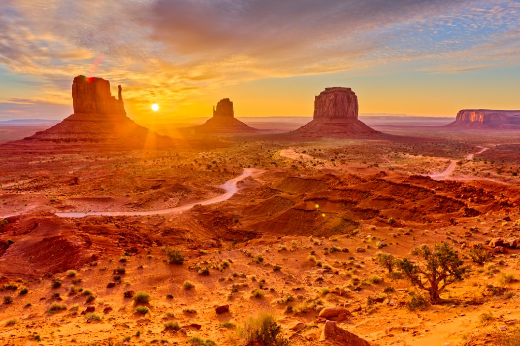
After this visit, take US 89 North and then, after 15 miles, turn right on US 160 East to Kayenta. There, you can visit the Monument Valley Navajo Tribal Park located on the border of Utah and Arizona in the area of the Navajo Indian reservation. It is the so-called “tribal park,” which is managed by Indians. In the park, like in all Indian reservations, drinking alcohol is forbidden.
At the end of the paved road, you will find a visitor centre with a large panoramic terrace (there is an admission fee) which lies on a promontory and offers wide views of the stunning area. From the visitor centre, you can, among other things, admire the Left Mitten and Right Mitten. Monoliths like the Totem Pole, which reaches the height of 143 m, Three Sisters, Big Hogan, and the stone arch, called Sun’s Eye, can be only seen from inside of the park. The formations have been created by successive Earth upheavals, volcanic eruptions, and then, by wind and water erosion – the processes took many centuries.
John Ford, the famous film produced from Hollywood, made the valley a famous film set, due to the production of many movies about the Wild West. Many visitors claim that the valley cannot be described with words; one should simply see it with one’s own eyes.
Highlights & Tips
Monumental landscape in the Monument Valley
It is possible to enter the Monument Valley Navajo Tribal Park between 7 am and 8 pm from the mid-March to late Semptember, an access fee per person is mandatory. You have the possibility to drive into the valley. However, the roads are unpaved. You can also decide to take a jeep ride. You can reach the Valley of the Giants only with a guide who is, of course, a Navajo Indian. The jeep rides that take place at dawn are very popular. There is a lot of sun and light; there may also be a few clouds – it is still a great natural spectacle.
Kayenta – Lake Powell/Page
Suggested route: Kayenta – Marsh Pass – Lake Powell/Page
Stage distance: approx. 100 miles / 160 km
You exit Kayenta, and head on US 160 West, through a 2,057-metre-high Marsh Pass. After about 32 miles, you will turn left on SR 98 West to Page (64 miles). You will reach the Glen Canyon Dam and Lake Powell, then, you will pass Page to reach a short stretch of US 89 and continue to the north.
Page was founded in 1957 by the construction of the reservoir. Lake Powell is located in the Glen Canyon National Recreation Area which stretches between the Grand Canyon National Park in Arizona and the Canyonlands National Park in Utah. The lake is almost 300 km long and is one of the largest reservoirs in the USA. You can find there a hydroelectric power plant that generates enough energy to power many cities and industries in the West.
Highlights & Tips
Dam management at the Glen Canyon Dam
The Glen Canyon Dam is one of the largest dams in the United States. Guided tours take place between June and August. Visitor centre is open from 7 am to 7 pm between June and August, and between 8 am to 5 pm throughout the rest of the year.
The boat to the Rainbow Bridge
The easiest way to visit the largest natural bridge in the world, the Rainbow Bridge, which is located about 50 miles (80 km) from Lake Powell Lodge, is by boat. From the dock, there is a short walk, about 400 m, to the bridge. The construction is 84 m wide and 88 m high. The shape of this huge bridge is almost a perfect arch, which resembles a rainbow – hence the name. The bridge is one of the seven wonders of the world and a holy place for the Navajo.
Lake Powell – Bryce Canyon
Suggested route: Page – Kanab – Mont Karmel Junction – Long Valley Junction – Rubys
Stage distance: approx. 160 miles / 260 km
After just 75 miles (120 km) on US 89 North, you will reach Kanab, a nice Mormon village, which is quite inviting when compared to the desolation of its surroundings. About 14 miles (23 km) towards Kanab, the road branches to the left. It leads to the Coral Pink Sand Dunes State Reserve. Later, you will start driving towards Mt. Carmel Junction and after 60 miles you will drive right on the US 12 East. After 13 miles, turn right on SR 63 to the Bryce Canyon.
Kanab is also known as “little Hollywood,” as the red hills have been the film backdrop since the 1930s. The Coral Pink Sand Dunes State Reserve (there is an admission fee per vehicle) is characterised by sand dunes, canyons, and rivers, which also became a film set. This state park has existed here since 1963. The dunes are only between 10,000 and 15,000 years old, which is a very young age when it comes to geology. The strange colour of the dunes, which are constantly rearranged by the winds from the hot south, comes from a high concentration of iron oxide in the sand. Here, you will be at an altitude of about 1.829 metres; even at an altitude of 2.100 metres vegetation can still be found. The ride, which will take you to the end of the park and back, is about 22 miles (35 km) long. Again, you need to go back on US 89.
The Bryce Canyon is certainly one of the greatest natural attractions in North America, even if its name is actually a misnomer. It is, in fact, not a canyon but rather a collection of natural, half-shaped cavities located on a steep slope. Bryce is a large amphitheatre. Due to more progressive weathering, the plateau edge has been shrinking about one-third of an inch (less than 1 cm) per year. The bizarre pillars, towers, and bridges made of limestone and sandstone shimmer, owing to the play of light and shadow, in red, yellow, brown, and purple.
Highlights & Tips
Pay attention to time zones!
Today’s route also comes to Utah. Once you are in the State of Utah, you should check the time because you are in a different time zone than in California, and during the summer, also in a different time zone than in Arizona.
Bryce Canyon
The ideal time to visit this canyon is in the afternoon, between 4 pm and 5 pm. Pass the visitor centre (immediately past the entrance), and stock up on information. The visitor centre is open daily from 8 am to 4.30 pm as well as between 6 pm and 8 pm during the summer months. Then, your first stop should be the Sunset Point. From here, we recommend a 1.5-mile (2.4 km) hike which takes about 1.5 hours. If you are an early bird, you will not miss the sunrise at the Point of Sunrise on the next day.
Bryce Canyon – Las Vegas
Suggested route: Bryce Canyon – Zion National Park – St. George – Las Vegas
Stage distance: approx. 255 miles / 420 km
Today's highlight is the Zion National Park located in the southern part of Utah. Here, you can see colourful canyons with gigantic formations of limestone, sandstone, and shale which have been unearthed and polished by million years’ work of the Virgin River. Drive through the Zion Canyon up to the Temple of Sinawava, over the West Temple, the Watchman, the Beehives, Three Patriarchs, and the Great White Throne.
From the natural spectacle, you will head towards the gliterring world of Las Vegas. The atmosphere of the city has changed a lot over the years – from the former pure players’ paradise in the 50s, it turned into an entertainment metropolis of superlatives. The transformation began in 1968, with the opening of the Hotel Circus Circus, where circus performances were held. The trend continued with hotels like Mirage or the fabulous-looking Excalibur. Then, Tresure Island opened its doors and was well-known for its theme of adventures and pirates. Right next door, you can enjoy the noble atmosphere of one of the most famous casinos in the world. In Hotel Monte Carlo Casino, you enter the world of the rich. The Bellagio, constructed in the style of a Tuscan villa, and the Venetian, with its artwork, are also worth seeing. The city centre was opened on Las Vegas Boulevard, between the Bellagio and Monte Carlo Hotel, at the end of 2009. It features a large shopping mall and several hotel complexes. At Caesars Palace, you will find Forum Shops, an elegant shopping centre taking you back in time to Ancient Rome.
Highlights & Tips
Nature in the Zion National Park
A walk towards the entrance to Anniversary Narrows is recommended, as this trail is flat. It begins at the end of a paved road. Another interesting highlight is the Emerald Pools, falling like a delicate veil of water over a rock wall. Here, you can climb them slightly, and your effort will be rewarded with great views. The climb begins on the other side of the parking lot of the Zion Lodge. As in all national parks, you can obtain additional information at the visitor centre. This visitor centre is open on a daily basis from 8 am to 7 pm during the summer.
Las Vegas
At the northern end of the “Strip,” you will find a 300-metre-high hotel tower, Stratosphere, which is equipped with a view point and a revolving restaurant. An open-air roller coaster that runs around the top of the tower will provide you with a special type of thrill. You can leave the top of the tower using a hydraulic catapult.
Las Vegas – Lone Pine
Suggested route: Las Vegas – Death Valley – Lone Pine
Stage distance: approx. 260 miles / 370 km
The drive to the valley itself is about 120 miles long. From the centre of the “Valley of Death,” you will drive on SR 190, also known as the North Highway, first to the north and then, to the west through Stovepipe Wells and through the Panamint Range of the Valley of Death towards Olancha. Drive straight on SR 136 West towards Lone Pine and then, drive 17 miles right on US 385/Main Street towards Bishop. At the intersection of US 395 and SR 136, there is a very interesting visitor centre. From here, you can admire a beautiful view on Mount Whitney, which is 4,418 m high and thus, is the highest mountain in the mainland United States.
The Death Valley with its national park offers unexpected contrasts. The valley is between 6 and 26 km wide and about 190 km long. There are over 900 different plant species, of which 21 can be found only in the valley itself. Badwater, located 86 metres below sea level, extends up to Telescope Peak, which is 3.368 m high. You cannot miss a visit to the salt water pool of Badwater, the lowest point in the Western Hemisphere, which often has a strong smell of sulphur.
Highlights & Tips
Drive through the Death Valley
Due to the fact that the Death Valley is one of the hottest places in the world, it is advisable to carry enough water, both for yourself and for the car. Please do not forget about a timely filling up of the tank. If the coolant in the car is too hot, you need to turn off the AC, and the water will cool down a bit (the same applies to mountain rides). If the water starts boiling, you need to stop, open the hood, but remember to close the cooling water tank. After the engine has cooled down, you can slowly open the cap and refill it with water. Although the registered temperatures reach 57°C, there is some heavy rainfall in the summer which can lead to flooding. The visitor centre, located near the Furnace Creek Ranch, offers interesting insights. You will also find a petrol station here. It is expensive to buy food and fuel in the Death Valley, as prices are higher than elsewhere.
Lone Pine – Fresno
Suggested route: Lone Pine – Sequoia National Park – Fresno
Stage distance: approx. 139 miles / 225 km
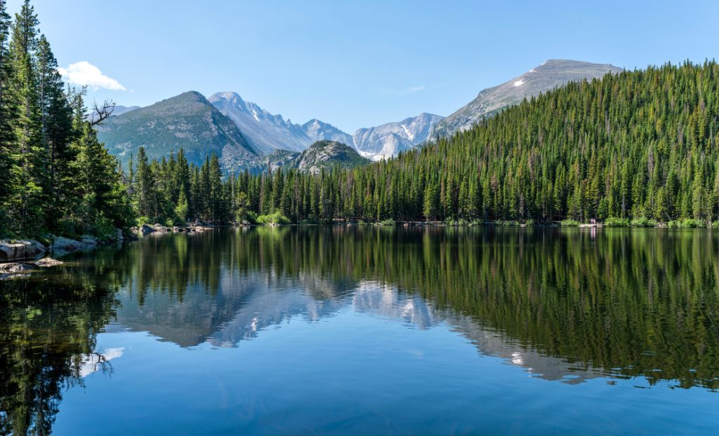
The Generals Highway is the only connection between the Sequoia and Kings Canyon Parks. The two adjoining parks lie in the middle of the Californian high mountains, the Sierra Nevada, a roughly 500-kilometre-long and 100-kilometre-wide mountain range. Giant sequoias, the last still living sequoias, and several types of coniferous trees grow in the area. Due to the fact that there is a major climate difference in both parks, you will find there an enormous variety of plants. There are also 200 species of birds, bears, mule deer, porcupines, squirrels, and chimpunks. Raccoons, grey foxes, and bobcats can be spotted at night occasionally. What is more, it is sometimes possible to spot mountain lions, bighorn sheep, and martens.
Worth seeing in the Sequoia National Park is also the General Sherman Tree, located in the Giant Forest. It is the largest surviving sequoia. The age of this tree is estimated to be between 2,300 and 2,700 years. It is about 84 m high and has a diameter of about 9 m. Many of other sequoias are not much smaller. One of the reasons why sequoias can grow so old is the high content of tannins and tannic acid, a substance preventing insect and fungal infestations. In addition, they contain no resin and therefore, they are very resistant to fire.
Moro Rock, a dome-shaped block of granite which is roughly 2.000 m high, is very impressive. From the highest point that can be reached via special steps that are cut into stone, you will have a beautiful view of the valley, the mountain range in the east, and the dense overgrown forest.
An interesting mountain road leads into the Kings Canyon. It runs along the Kings River through deep and narrow canyons to Cedar Grove. Along the way, you can admire the Roaming River Falls and other vantage points. A short walk will take you to the Zumwalt Meadow. Down the valley, you can take the Cedar Grove Motor Trail, a one-way dirt road that is about 3.5 miles (5.6 km) long.
Highlights & Tips
Time of the year is important
During the summer, the heat is very bothersome in the Kings Canyon National Park in comparison to the Sequoia National Park. This is due to the fact that the warm air stays in the canyon. If you are travelling in winter time, the remote areas will not be accessible at this altitude due to the snowfall. What is more, some of the roads are closed as well.
Fresno – El Portal
Suggested route: Fresno – Yosemite National Park – El Portal
Stage distance: approx. 215 miles / 345 km
After entering the Yosemite National Park, you should pay a visit to the Mariposa Grove. There, you will find sequoias – the oldest of them, called Grizzly Giant, is about 2,700 years old. Through Wawona, you will drive on SR 41 North towards the Yosemite Valley. In Chinquapin, you will come to a junction, where you will turn right to the Glacier Point (about 50 km away from the Yosemite Valley), which is one of the highlights of the Yosemite National Park. From here, you will enjoy great views of the Yosemite Valley lying around 1,000 m below you.
From the Yosemite Valley, you will see El Capitan, the largest granite monolith in the world, the Half Dome, and several waterfalls, especially the Yosemite Falls –one of the highest waterfalls in the world with a height of 739 m. In the summer months, it is possible, however, that the falls become completely dried up.
Highlights & Tips
Indian culture in the Yosemite Valley
The visitor centre in the Yosemite Valley is open daily from 9 am to 5 pm. In the Indian Cultural Museum, you can marvel at very interesting exhibitions involving the works of Miwok and Paiute Indians.
El Portal – San Francisco
Suggested route: El Portal – Maripiosa – Modesto – San Francisco
Stage distance: approx. 190 miles / 310 km
Today, you will drive towards San Francisco. You should choose the route via Mariposa, the Spanish word for butterfly, a former gold rush town with some well-preserved old houses. The local courthouse is the oldest courthouse in the States and is still used as such.
In the north of the San Joaquin Valley, along the Tuolumne River, your next station will be Modesto, which is the geographical centre of the State of California. Every year in mid-June, Graffiti USA takes place here. It is a street festival with music from the 1950s, various forms of art and craft, and an exhibition of classic cars, like in the film “American Graffiti.”
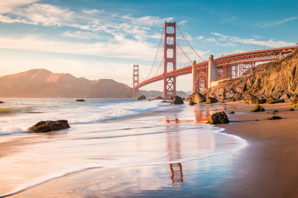
Afterwards, you will reach San Francisco. We certainly do not need to recommend driving through the Golden Gate Bridge, paying a visit to Fisherman’s Wharf, or taking a ride on a cable car. No visitor to San Francisco will miss these sights. San Francisco is a city that one can admire without the need of travelling by car.
Once you reach Grant Avenue, you are in Chinatown. The area includes about 16 city blocks and is the largest area where Chinese live outside of Asia. If you take a ride on a cable car to Fisherman’s Wharf, you can admire the “Crookedest Street in the World.” This “crookedest street” is Lombard Street located between Hyde Street and Leavenworth Street. Fisherman’s Wharf offers Pier 39, where the San Francisco Experience Museum can be found, next to shops and restaurants. Boat trips begin on Pier 41 and Pier 43 1/2. If you go a few blocks from Taylor Street to the west, you come to Cannery, a former cannery with many boutiques, specialty shops, and restaurants. On the Embarcadero, you will be entertained by street performers. Watch out for pickpocketers (especially here).
Highlights & Tips
49 Mile Scenic Drive
If you want to explore the city on four wheels, you need to find the blue-and-white seagull that marks the „49 Mile Scenic Drive”, a 49-mile-long (79 km) tour around the city. This route begins at the Civic Center and runs through Market Street, Hayes Street, Franklin Street, and Golden Gate Avenue. It will take you, among other places, to the following points of interest:
- Union Square
- Nob Hill, an elegant residential area where the Grace Cathedral is located
- Golden Gate Bridge
- Lincoln Park
- Golden Gate Park with the California Academy of Sciences. Here, you can find an aquarium, a planetarium, and the M. H. De Young Museum, which, among other things, houses 7,000 works of Asian art from the Avery Brundage Collection
- Twin Peaks, from where you have a beautiful view of the whole San Francisco – especially on a clear day. What is more, you can also admire the bay, the bridges as well as the Berkeley Hills.
- Financial District
Boat trip to the Island of Alcatraz
Here, you can visit the former prison for felons, where infamous gangsters such as Al Capone and Robert Stoud, the “Birdman of Alcatraz,” were imprisoned. Wearing warm clothes (even during the summer) and comfortable shoes is recommended.